jueves, 12 de noviembre de 2015

Perú, Cordillera Blanca 2015

En el principio
La idea de este viaje me viene dando vueltas en la cabeza desde hace algunos años, cuando mi amigo Martín me contó sobre sus viajes a la Cordillera Blanca de Perú. En los años anteriores, por distintas razones, no pude acompañar a Martín, pero este año no me pude negar. Así que a principios de Julio estábamos viajando a Lima, desde Buenos Aires, justo en la mitad de la final de la Copa América, disputada entre Argentina y Chile (no soy muy fanático del fútbol, como verán...)

In the beginning
The idea of this trip has been turning around in my mind since some years ago, when my friend Martín told me about his journeys in the Cordillera Blanca of Perú. In the previous years, for different reasons, I couldn't join Martín, but this time I couldn't say no. So at the beginning of July we were traveling to Lima, from Buenos Aires, just in the middle of the final game of the "Copa American" football coup, between Argentina and Chile (I'm not a football fanatic, as you can guess...)

Vista de Huaraz y la Cordillera Blanca, desde el barrio Los Olivos.
Los picos nevados tiene entre 4500 m y 6400 m de altura.
Huaraz and Cordillera Blanca view, from Los Olivos.
The peaks in the background are about 4500 m ad 6400 m high.

martes, 27 de octubre de 2015

Comiendo en movimiento [Eating on the move]

Después de cierto tiempo haciendo ejercicio aeróbico (correr, pedalear, caminar, o cualquier deporte que lleve más de, digamos, una hora) uno empieza a sentirse con hambre y sed. Y acá es donde aparecen las preguntas: ¿Qué comer y beber? ¿y cuándo? ¿antes del ejercicio? ¿durante? ¿después? ¿cuánto? ¿qué tipo de comida? etc, etc...
Bueno, hay mucho escrito sobre todo esto, y cada uno debería probar qué combinación funciona mejor para su cuerpo, pero después de leer un poco y experimentar con migo mismo llegué a las siguientes ideas que a mi me funcionan:

After some time doing aerobic exercise (running, cycling, walking, or whatever sport that spans more than, say, one hour) one starts to feel hungry and thirsty. And here the question arise: what to eat and drink? and when? before the exercise? during? after? how much? what type of food? etc, etc.
Well, there's a lot written about that, and everyone should try for itself what works better for his body, but after reading and experimenting with myself I've found the following system which works for me:


Pasas de uva en su botella, el cordín es para colgarla del arnés.
250 gr de pura dulzura (unas 750 kcal). Manzanas como escala.
Raisins in its bottle, the cord is to hang it from a harness.
250 gr of pure sweetness (about 750 kcal). Apples for scale

miércoles, 12 de agosto de 2015

Buscando algo de nieve [Searching for some snow]

Parece que el invierno está llegando, cayó algo de nieve a fin de mayo y principio de junio, no demasiado, pero mejor que nada... La idea es esquiar un poco antes de julio, porque me voy de viaje a Perú por cuatro semanas, y creo que voy a extrañar un poco el esquí...
Este año el clima viene parecido al invierno pasado: caen algunas nevadas seguidas por un aumento de la temperatura, así que el manto de nieve está bastante fino, y tenemos nieve primavera a fin del otoño.
A fin de mayo cayó una nevada, y no pudimos resistir la tentación de ir a ver cuánta nieve había en el cerro Tronador, cerca del refugio Meiling. Este es el pico más alto de la zona de Bariloche. El manto de nieve era fino pero igual pudimos hacer algunas bajadas, y un poco de escalada en hielo en las grietas del glaciar.

It seems that winter is coming, some snow has fall down here at the end of May and beginning of June, not too much, but better than nothing... The idea is to get some skiing before July, because I'll be travelling to Perú for four weeks, so I think I'll be missing a bit the skiing...
The weather this year has a similar behavior than last year: some snow storms followed by a rise in temperature, so we tend to have a thin snowpack with spring snow conditions in late autumn.
At end of May a storm left some snow, we couldn't resist the temptation to get a look at the snow slopes up in cerro Tronador, near Meiling hut. This is the highest peak around Bariloche. The snowpack was thin but we managed to get some turns, and some ice climbing in the crevasses.

¿Habrá algo de nieve che?
Would there be some snow?
Y, es fin de mayo, ¿que esperabas? La vista vale la pena, de todas formas
Well, its end of May, what did you expected? Anyway, the view is amazing

martes, 10 de marzo de 2015

Caminando por las Cinco lagunas [Walking through the Five Lagoons]

El domingo pasado fui a caminar con Martín las Cinco Lagunas, una salida que tenía ganas de hacer desde que me vine a vivir a Bariloche en 2010. El camino comienza en Colonia Suiza, al oeste de Bariloche, y termina en Pampa Linda, al pie del cerro Tronador. Durante la caminata se pasa por cinco lagunas: Laguna Negra, laguna CAB, laguna Cretón, laguna Jujuy y laguna Ilón. De pasada también se ve la laguna Azul, el brazo Tristeza del lago Nahuel Huapi, y una buena pila de montañas. Por lo general, la gente hace la caminata en tres o cuatro días, acampando cerca de las lagunas, aprovechando los días de verano para bañarse y eso. 

The past Sunday I went out walking with Martín through the Cinco Lagunas (five lagoons) trek, a circuit I wanted to do since I moved to Bariloche in 2010. The trail starts at Colonia Suiza, Bariloche, and ends up in Pampa Linda, at the base of mount Tronador. During the trek, you pass by five lagoons: Laguna Negra, laguna CAB, laguna Cretón, laguna Jujuy and laguna Ilón. Normally, people do the trek in three or four days, camping near the lagoons, taking advantage of the summer hot days to take a bath and so on.

Mapa de las Cinco Lagunas
Cinco Lagunas trekking map
 

viernes, 23 de enero de 2015

Invierno 2014 [Winter 2014]

Bueno, la idea era escribir un poco durante el invierno sobre esquí de travesía en Bariloche, pero (como siempre) no tuve tiempo. Así que mejor escribo todo junto, algo así como un resumen del invierno pasado.

Well, the idea was to make some blog post during the winter about skiing around Bariloche, but (as usual) I didn't have the time. So I thought about putting it all together in one post, something like a summary of this past winter.


Buscando un poco de nieve, cerca del cerro Bella Vista.
Searching for some snow, near Bella Vista hill.


domingo, 23 de noviembre de 2014

Cruzando a Chile en bicicleta [Pedaling to Chile and back]


Después de mi primer viaje en bicicleta exitoso, en enero de 2011, tenía ganas de seguir pedaleando. Todavía era verano, los días tenían muchas horas de sol y no estaba demasiado fresco. Así que empecé a mirar el mapa para planear el siguiente viaje en bicicleta.
Todavía tenía la idea de cruzar a Chile ida y vuelta, desde una charla que tuve con una amiga unos años antes. Así que esta vez la idea era empezar a pedalear en San Martín de los Andes, salir para el norte hacia el paso Carirriñe, cruzar a Chile, después viajar hacia el sur en dirección al lago Pirihueico, cruzar de vuelta la frontera por el paso Huahum, y finalmente seguir hacia el este para volver a San Martín de los Andes.
El próximo fin de semana era feriado de carnaval, así que tenía cuatro días para completar el viaje. Mirando el mapa, todo el viaje eran algo de 210 km y 4000 m de trepada. Se veía interesante...

After my first successful bike trip in January 2011, I was eager to go for more. It still was summer, the days had a lot of sun hours and it wasn't too cold. So I started looking at the map to plan my next trip.
I still had the idea to go to Chile and back, based on a chat I had with a friend some years ago. So this time the idea was to start at San Martín de los Andes, go north towards Carirriñe pass, cross to Chile, then travel south towards Pirihueico lake, cross the border again through Huahum pass, and finally continue to the east to get back to San Martín de los Andes.
The carnival holidays where coming, so I had four days to complete the trip. Looking to the map, the whole trip was about 210 km and 4000 m of climb. It looked interesting...


Mapa del viaje, saliendo y llegando en San Martín de los Andes. Hice el recorrido en sentido anti horario, cruzando a Chile por el paso Carirriñe  y volviendo a Argentina por el paso Huahum.
Map of the trip, starting and finishing in San Martín de Los Andes. I did it in counterclockwise direction, crossing to Chile through Carirriñe pass and getting back to Argentina by Huahum pass.


martes, 22 de julio de 2014

Encerando los esquíes [Waxing your skis]

Hace algunos años escuché que era necesario encerar los esquies para que esquien mejor. Creía que no era tan importante, hasta que un día fui a esquiar con unos “lápices” que compró mi papá hace unos veinte años más o menos, hacía unos diez años que no veían un poco de cera. Así que tratar de deslizar con esos esquies no era fácil, lo cual complicaba iniciar los giros, o tratar de controlar los esquíes de alguna forma. Así que me pareció que era buena idea darle una oportunidad a la cera antes de echarle la culpa a los esquíes por mi falta de habilidad en las pistas. Resultó ser que los esquies anduvieron mucho mejor después de encerarlos, incluso podía controlarlos adentro de la pista (fuera de pista ya era otra historia, pero ahí era culpa del esquiador, no del equipo).

Some time ago I heard that you needed to wax your skis so they will ski better. I used to thought that it wasn’t so important, until I go out skiing with a couple of “sticks” my father bought about twenty years earlier, they hadn’t seen wax in the last ten years maybe. So, trying to slide with those skis wasn’t easy, that make it difficult to initiate a turn, or to control the skis in any way. So I thought I may give the wax a try before blaming the old skis for my lack of ski abilities.
It turned out that these old skis skied much better after waxing them, I could even control them inside the groomed slopes (off piste was another story, but thats the rider’s fault, nothing to blame to the gear). 

lunes, 7 de julio de 2014

Esquiando un poco [Getting some skiing]

Bueno, me parece que estoy escribiendo demasiado… Van algunas fotos esquiando por la zona de Bariloche y alrededores, de las temporadas 2012 y 2013, espero que les gusten...

Well, I think I’m writing too much… Here are some skiing pictures near Bariloche, from season 2012 and 2013, I hope you enjoy…


Cerro Catedral, Bariloche, antes de que abra la temporada. Una vista un tanto inusual, comparado con la temporada alta: Casi no hay gente, pistas sin pisar, nieve virgen (y piedras), no se escucha música, y no se mueven los medios de elevación.
Cerro Catedral, Bariloche, before the season starts. Kind of unusual view, compared with high season: Almost no people, ungroomed slopes, wild snow (and rocks), no music, and no lifts moving.

Subiendo al cerro Challhuaco, Bariloche, con Ana, Santiago y Matias (de izquierda a derecha). La cumbre se ve arriba a la derecha. Esto fue después de dos días de una tormenta de nieve húmeda, así que la nieve estaba pegoteada por todos lados. Vimos varios árboles caídos culpa de esta tormenta (otra razón para no ir a esquiar los dias de tormenta).
Heading up to Challhuaco hill, Bariloche, with Ana, Santiago and Matias (from left to right). The summit can be seen at the top right of the photo. This was after two days of a wet snow storm, snow was sticking to everithyng. We saw a lot of trees recently fallen down (another reason not to ski on storm days).

Cumbre del Challhuaco:  Santiago, Matías, Ana y yo, de izquierda a derecha. Muchas montañas para explorar al fondo, mirando hacia el sur. El cerro Carreras es uno de los más altos de la zona, con cerca de 2400 m de elevación (está en algún lado en la foto, ahí de fondo), altura similar al cerro Siete Colores (también por ahí al fondo) y cerro Catedral (no salen en la foto). Tronador es el pico más alto de la zona con unos 3490 m.
Challhuaco summit:  Santiago, Matías, Ana and me, from left to right. A lot of hils to explore looking south, Carreras hill is one of the highest of the zone, about 2400 m of elevation (it is somewhere there in the background), similar height than Siete Colores hill (also there in the background) and Catedral hill (not seen in the picture). Tronador is the highest peak of the region with about 3490 m.

martes, 1 de julio de 2014

¿Esquí de travesía? ¿Qué es eso? [ Backcountry Skiing? what’s that? ]

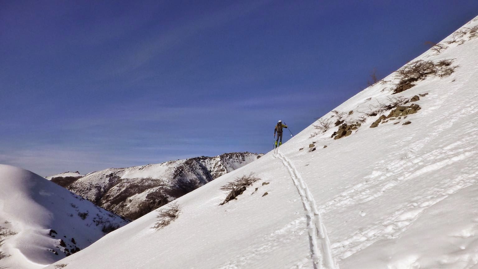
Había escuchado hablar del Esquí Alpino y del Esquí Nórdico, incluso del Telemark, ¿pero qué es esto del Esquí de Travesía? Eso fue lo que pensé la primera vez que escuché hablar de este deporte. Era el invierno (en el hemisferio sur) de 2010 y un amigo estaba comentado sobre un curso que estaba haciendo con el Club Andino Bariloche. Ahí me explicó que la idea era subir a la montaña por tus propios medios, sin usar la telesilla o cualquier otro medio de elevación. Una vez arriba, bajás esquiando como en el esquí alpino.

Entonces, la siguiente pregunta fue ¿Y cómo subís una pendiente con los esquíes puestos? ¿de costado, tipo escalera? Eso ya lo probé y no es de lo más cómodo… Bueno, en realidad la idea es usar una especie de alfombra sintética (pieles) que se “pega” a la base del esquí, esto permite que el esquí deslice hacia adelante pero se bloquee cuando quiere deslizar hacia atrás, y también se usa una fijación especial que te permite liberar el talón de la bota, permitiendo que pivote en la punta. Y listo, te pones las botas, pegas las pieles al esquí y empezas a patinar para arriba por la pendiente. Una vez arriba, “despegas” las pieles, ajustás el talón de la bota (¡y las botas!) y esquiás para abajo en el estilo que más te guste.

La idea parecía interesante, tenía que probarlo...


I’ve heard about Alpine Skiing and Nordic Skiing, even about Telemark, but what is Backcountry Skiing? Those were my thoughts the first time I heard about this sport. It was the winter (south hemisphere) of 2010 and a friend was talking about a course he was taking in with Club Andino Bariloche. So he explained me that the idea was to go up the mountain by your own means, without using the chairlift or other mechanical aid. Once you were up, you skied down like in alpine skiing.

So, the next question was "and how do you go up a slope with your skis on?" sidestepping? that would be too tiring, walking? I’ve tried that and is not very enjoyable… Well, no, the idea is to use a synthetic fur ("skins") you “paste” to the bottom of the skis, which allows the ski to slide forward but not backwards, and you also use a special binding which can free the heel of the boot so that it pivots in the toe. And you are done, you put on your boots, paste the skins to the skis and start sliding up the slope. Once at the top, “unglue” the skins, lock the heel (and the boots!) and ski down in your preferred style.

The idea looked interesting, I needed to try it...

Probando esto del Esquí de Travesía, parece que va bien eh (foto por Martín).
Trying out Backcountry Skiing, it looks good eh (photo by Martín).

miércoles, 18 de junio de 2014

Pedaleando por la ruta de los Siete Lagos [Biking through Seven Lakes route]

Después de mi primer intento de viaje en bicicleta, que terminó antes de lo previsto, empecé a planificar otro viaje. Esta vez entrené un poco más, me mudé a Bariloche a mitad de año así que tenía varios caminos de montaña para entrenar, a diferencia de La Pampa donde es todo bastante más plano.

Así llegó enero de 2011, con más entrenamiento y no tanto tiempo, así que mirando un poco el mapa cerca de Bariloche, se me ocurrió un recorrido por acá cerca nomás: La idea era salir desde la confluencia del río Limay y Traful (donde está la estación de servicio del ACA) hacia Villa Traful, empalmar la ruta de los Siete Lagos (que va desde San Martín de Los Andes a Bariloche), seguir hacia el Norte, y después tomar el desvío a Villa Meliquina para volver a Confluencia por Paso Córdoba.


After my first bike trip ended a little bit soon, I started planning another one. This time I trained some more, I was living in Bariloche so I had some hilly roads to train, compared with La Pampa which is mainly flat.

So january 2011 arrived, I was more trained but didn’t have too much time, so looking the map near Bariloche I found a route not so far away: The idea was to start at the junction between Traful and Limay rivers (where there is a gas station) heading to Trafull Village, connect with the Seven Lakes road (which goes from San Martín de Los Andes to Bariloche), continue north and then turn east heading to Meliquina Village in order to get back to Confluencia through Córdoba Pass.


Mapa del viaje en cuestión, en sentido horario, saliendo de Confluencia.
Map of the planned trip, clockwise, starting at Confluencia.